Free UK delivery on orders over £25 · Every piece made to order in Wimbledon
DENSIAN DESIGN
New

3D Hex Map Puzzle

Any place or Strava route

Shop rated 4.9 from 118 reviews
£49.00+ free UK delivery

Anywhere you love as a hexagonal 3D jigsaw, coloured like a satellite photo, with the contour lines waiting in the tray underneath.

Size
Style
Map colours
Tray
Contours and rim text

A place name, postcode, a dropped-pin link or a public Strava activity. GPX file? Write GPX here and email it after ordering.

Separate the sides with a /. About 18 characters each. Leave blank and we use the coordinates, height range and scale.

Made to order for you in Wimbledon
You approve a preview first, then it is printed and dispatched in 5 to 7 working days
Secure checkout by Stripe
About

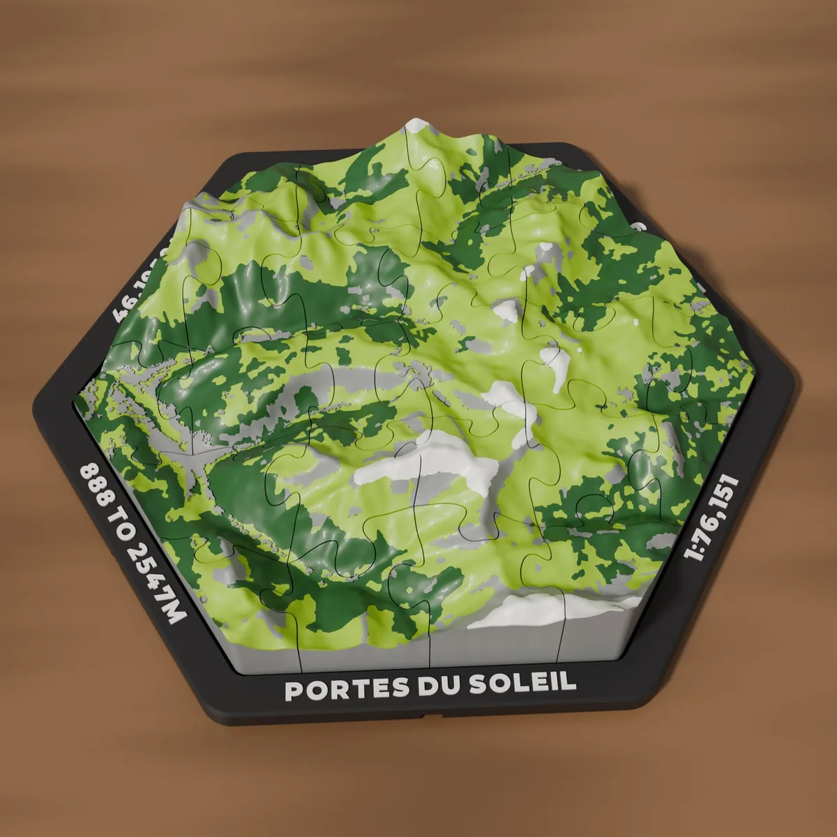
A hexagonal 3D printed map of anywhere you love: the ski resort you go back to every winter, the mountains you have walked, your home town or the route you ran. Real terrain from elevation data, coloured like a satellite photo in four colours, cut into a classic jigsaw that sits in its own tray. Lift the pieces out and the tray floor carries the contour lines of the same ground.
What you get
  • The map, printed in four colours in one run: jigsaw (about 24 pieces on the Medium, about 30 on the Large) or one solid piece
  • The hex tray with your text raised on all six sides and the contour lines inlaid in the floor
  • Pegs: a hole under every piece lines up with one in the tray floor, so it can be fixed for good
  • 2 shelf stands and a hidden wall bracket with screws and plugs
  • Join keys: a socket under every side locks hexes together into a wall of places
Details
  • Satellite colours: forest green woods, lime green meadows, grey rock, towns and lakes, white snow on the high peaks, from real land cover data
  • Classic colours: white terrain, grey buildings and roads, a red route and navy water. Best for cities and routes
  • Add a Strava route to a Satellite map and the red route takes the place of one colour, usually the snow
  • Height follows the ground: about 1.5cm for a flat town, 3.9cm for the Avoriaz map shown, taller for the biggest mountains
  • Heights from real elevation data, exaggerated 1.5 times vertically so the relief reads
  • You get a preview of your exact map to approve before anything prints
  • Contains small parts: not suitable for children under 3
  • PLA. Keep away from radiators and strong direct sun
  • Map data OpenStreetMap contributors. Not affiliated with or endorsed by Strava
Delivery & returns

You approve a preview first, then it is printed and dispatched in 5 to 7 working days. UK delivery by Royal Mail, £1.80 per order, or free on orders over £25. Because this piece is personalised to you, it can't be returned for a change of mind, but if anything arrives damaged or wrong Sam will put it right. Full details

£49.00